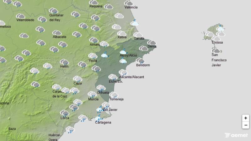
To be listed on the haciendadelalamo TODAY MAP please call +34 968 018 268.
Generalised Gota Fria warning issued for this weekend
Aemet have issued a generalised warning for this weekend, with Sunday likely to register heavy rains
Halloween weekend looks like being a bit of a damp squib for all those who have organised outdoor events and planned to spend the Festivals of All Saints and All Souls in the great outdoors.
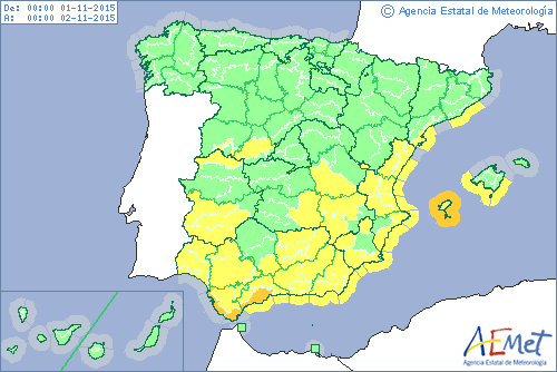
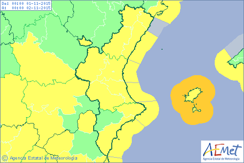
A westerly wind (a Levante) has started to bring in a new weather front this Friday, and from Friday evening lower cloudcover will put an end to the recent spell of agreeable late summer temperatures we have all enjoyed, which according to the state meteorological agency, Aemet, have been slightly higher than normal for the end of October.
This westerly wind will bring in humidity and winds, the first of which will be noticeable on Friday, although Sunday is expected to be particularly windy, with gusts of up to 70km/h. These will be particularly noticeable along coastal areas, so particular care should be taken near to the water’s edge as this could create dangerous conditions in areas which are prone to rough seas.
Although the weekend is expected to be cloudy, rains will probably hold off until Saturday evening, but Sunday is expected to be particularly stormy with rain forecast. At the moment the conditions are ripe for possible Gota Frias on Sunday evening, although at the moment no localised formal warnings have been issued.
Aemet have issued a general warning that the conditions this weekend could lead to these isolated torrential downpours, although it is impossible to predict exactly where these will take place.
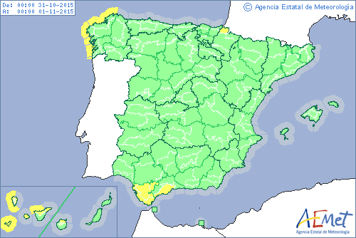
Aemet expects the rains to be at their most intense in the west of the peninsula on Saturday, the heaviest downpours being in the Straits of Gibraltar and Canary islands.
On Sunday the rainfall will be more widespread, the Balearics, Canary islands, Andalucia and the Valencia region specifically highlighted, although of course, the Region of Murcia lies right between these two so is unlikely to escape.
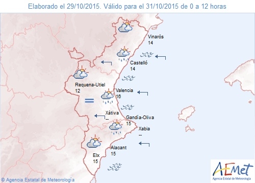
There have been warnings recently on the Alicante border that sea temperatures were still high due to the elevated temperatures this summer, thus extending the danger period for Gota Frias, and recently the Alicante coastline has witnessed some extremely heavy downpours and localised flooding.
Rains are expected to be most intense in the west of the region and in the more mountainous zones, and rains could well continue into Monday, although by Tuesday this front is predicted to move away.
Click here to read about what a Gota Fría is.
Images: Top 2 images Sunday, bottom image Saturday. Aemet


