To be listed on the haciendadelalamo TODAY MAP please call +34 968 018 268.
An 11-kilometre hiking route from Alhama to the mountain village of Gebas
The route from Alhama includes the Sierra de la Muela and ends in the foothills of Sierra Espuña
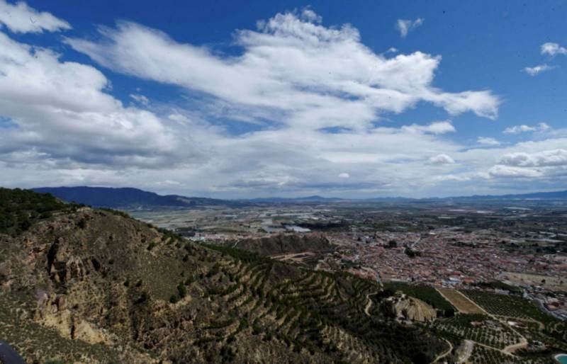 This hiking route from the centre of Alhama de Murcia (Jardín de los Patos) to the Mirador or viewing point of Gebas in the foothills of Sierra Espuña covers a distance of 11.23 kilometres and rises from 185 to 429 metres above sea level, generally taking around four and a half hours to complete. It is described as being of medium difficulty.
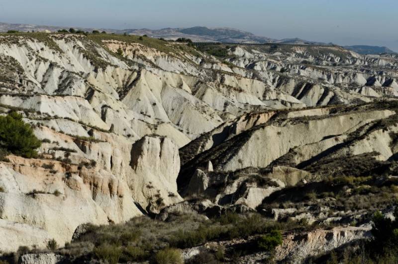
The walk is a variant of the GR 252 route and crosses the Sierra de La Muela, from the top of which there are great views of the mountains of Sierra Espuña on one side and the Guadalentín on the other. It also takes in the Tajo-Segura wáter distribution canal and crosses the Barranco de los Cojos and Barranco Hondo before reaching the Casa de la Fuente de los Arrieros and Gebas, from where it is possible to look out over the eroded water channels which lead into the reservoir of the Rambla de Algeciras.
Route
The walk begins in the Jardín de los Patos in the centre of Alhama and then follows Calle de la Feria past the church of San Lázaro and the Los Baños archaeological museum.
Take the road up on the left of the museum (Calle Vergara Pérez) until reaching the Fuente del Caño, then a staircase leads off on the right up towards the hill on which the castle of Alhama stands. Below the crumbling wall is a path alongside an old water channel which was used centuries ago by the Moors to bring water to the town centre from the “Manantial del Collao”.
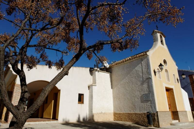
 At this point the road becomes a rural path and as it nears a clump of cypress trees it is necessary to go down to the lane (the Cordel de Lorca, a former transhumance farming track) which leads to the small church of La Candelaria: however, the route doesn’t go to the church, heading instead in the opposite direction on the left, the path to La Cuesta del Salto.
Underneath this path is the water pipe used by local irrigation farmers, and it leads to the start of another path which starts to head up the Sierra de La Muela: this section has recently been cleared and improved, and now, 2.25 kilometres into the walk, we continue on a path to the right between large boulders, still heading for the slopes of La Muela.
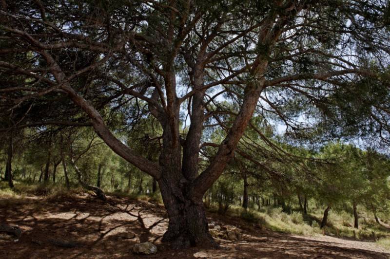
So far the route has been well signposted and now it continues through replanted pine trees, sometimes climbing stone steps, heading right at the panoramic viewing information panael and joining the path to the Collado de la Muela (3.67 km. altitude 452 m) on the left.
After 4.08 kilometres (altitude 487 m) we reach the Casa de La Muela, where a path leads off on the left and within three minutes we reach the viewing point looking out over Alhama and the fertile crop lands below. Here there is another panoramic information panel created by Natursport and the local “Miguel Hernández” secondary school.
It is an easy descent as we continue in the direction of Sierra Espuña, leaving a junction on our right (4.75 km, altitude 480 m) and crossing a landing area used by forest firefighting aircraft (5.08 km, altitude 477 m). Continue down to the tarmacked road alongside the water distribution canal, and head right along it.
 We are now on the northern side of La Muela with the canal beneath ground until it resurfaces on a straight (7.38 km, altitude 364 m) next to a 40 km/h speed limit sign. Here we leave the tarmac again to head down to the left on a path which takes us through pines, across the Barranco de los Cojos and to the junction with another path (7.41 km. altitude 359 m): this takes us uphill past almond trees until we reach a steep path (7.6 km, 379 m). This one leads to an area of flat ground with pine trees, heading left towards a smll peak after 7.88 km (altitude 392 m).
Here there is a junction on the left but we head right, going down to orange trees and a small white building until we reach the track to Cañada del Cucharón (8.07 km, 385 m). Head right here, with Gebas already visible in the distance, and soon (8.86 km, altitude 357 m) the track ends at Barranco Hondo.
We have to cross the Barranco and climb up to the road on the other side, where we head left: careful if there is running water and mud in the ditch!
There is now a route across the Rambla de Algeciras, which heads down from El Berro and eventually reaches the reservoir of Algeciras, and here there is a house on the right which in the past contained the Fuente de los Arrieros, a place of rest for travellers with mules who used to cross the high ground as they made their way to and from Alhama.
Stay on the tarmac until you reach the rural properties of Gebas Bajo and then climb up again, following the GR 252 signage, to the church of Gebas and the monument to pilgrims (10.71 km, altitude 425 m). Continuing on the road with streetlights we pass the houses of El Mojón, where a path to the right leads to the viewing point of the Barrancos de Gebas and the boundary stone between the municipalities of Alhama de Murcia and Mula.
 Finally, refreshments can be sought at the “El Mirador” restaurant, where this route finishes.
The hike is a variant off the major GR 252 route between Mazarrón and Caravaca de la Cruz, and from Gebas it is possible to continue either in the direction of El Berro and Totana or heading towards Caravaca de la Cruz.
Click here for accommodation in Alhama de Murcia. In Gebas the following facilities and services are available:
Accommodation
Hotel La Mariposa 968 631008
Casas rurales “Las Golondrinas” 968 636205
Casas rurales “El Lebrillo” and “La Tinaja” 968 631293
Casa rural “Las Palmeras” 968 639330
Casa rural “El Aljibe” 968 632198
Restaurant
Restaurante El Mirador 968 633644
Outdoor leisure activities
ECOESPUÑA 968 636205
ESPUÑA ACTIVA 667 914793
LA RANA VERDE 968 631037
CENTRAL DE RESERVAS NORATUR 902 106600
Oficina de Turismo de Alhama de Murcia

Alhama de Murcia Tourist information office is located on the edge of the Plaza de la Constitución, just a few metres away from the underground car park and the Town hall of Alhama de Murcia.
The tourist office offers free guided audiotours in English which take visitors around the historical sites of interest in Alhama. These be loaned at any time, although allow an hour and a half to complete the tour, and when loaning the audio equipment visitors are asked to leave passports or ID cards with the tourist office.
The office also carries a full range of leaflets for the archaeological museum of Los Baños, which is built around the historic spa which gives Alhama its name, and the mountains of Sierra Espuña, which is also an important area within the municipality of Alhama. Areas such as El Berro and Gebas have a number of interesting routes which can be followed and there are several picnic areas and good walking routes within the Sierra Espuña natural park.
The tourist office also carries leaflets for the many cultural events and fiestas which take place in Alhama throughout the year, including Los Mayos, Semana Santa, Christmas,the Romería of La Candelaria and the Auto de los Reyes Magos in El Berro.
Opening Hours
Winter (September 16 – May 31)
- Tuesday to Friday: 9am-2pm and 4.30pm-7.30pm
- Saturdays: 10am-1pm
- Sundays and Mondays: closed
Summer (June 1 to September 15)
- Tuesday to Friday: 08.30 to 14.30
- Saturdays: 10.00 to 13.00
- Sundays and Mondays: closed
For more local information, including news and forthcoming events, visit the home page of Alhama Today.


