
To be listed on the haciendadelalamo TODAY MAP please call +34 968 018 268.
Date Published: 25/11/2024
Temperature rollercoaster as Storm Bert hits: Spain weather forecast Nov 25-28
After a wet and windy start, the second half of the week should be warm and pleasant in most of Spain
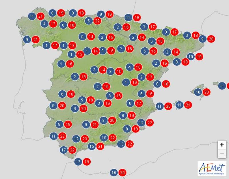
Average temperatures forecast on Thursday November 28
We’ve arrived at the last weekend in November and as we head towards a new month, Spain is set to experience four seasons at once over the coming days. Storm Bert is hanging around the northern half of the country, bringing with it plenty of rain and strong gales, and this cold front is expected to impact most of the country until mid-week.
However, from Wednesday onwards change is afoot: the temperatures will shoot up to values much higher than what we’d usually see this time of year and the blue, sunny skies should make a comeback.
Monday November 25
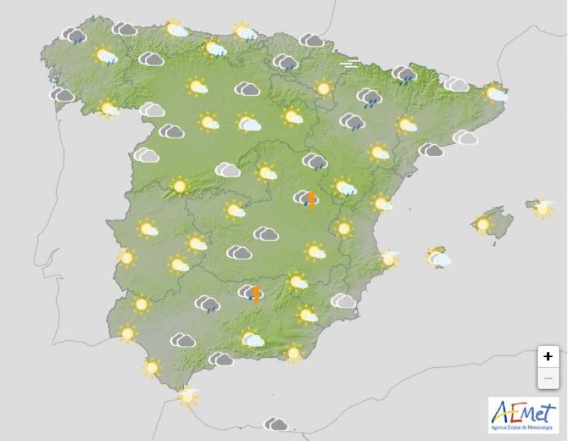
The strong winds and dreary rain that began over the weekend will continue in much of the north on Monday, leaving behind overcast skies and widespread stormy showers in the likes of Galicia, Cantabria and the surrounds of the Pyrenees.
It won’t be much brighter in the rest of Spain and although no heavy rain is forecast, there is a chance of showers pretty much everywhere, aside from the extreme southeast and the Balearic Islands.
The week will start off with falling temperatures; the mercury will hover around the high-teens for the most part, creeping into the low 20s in the south.
Orange alert for heavy rain and rough seas: Galicia.
Yellow alert for heavy rain and/or gusts: Andalucía, Aragon, Asturias, Cantabria, Castilla y Leon, Castilla-La Mancha, Catalonia, Extremadura, Navarra, Rioja.
Tuesday November 26
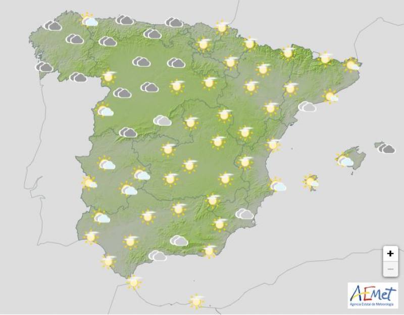
As Monday’s cold front retreats, a situation of high pressure will extend from central Europe towards Spain. However, several Atlantic fronts will interfere, resulting in dark skies in the north and lots of scattered rain in the west of Spain.
Daytime temperatures will plummet in most regions, and it will be noticeably cooler in the east of the country on Tuesday.
Yellow alert for dangerous sea conditions: Galicia.
Wednesday November 27
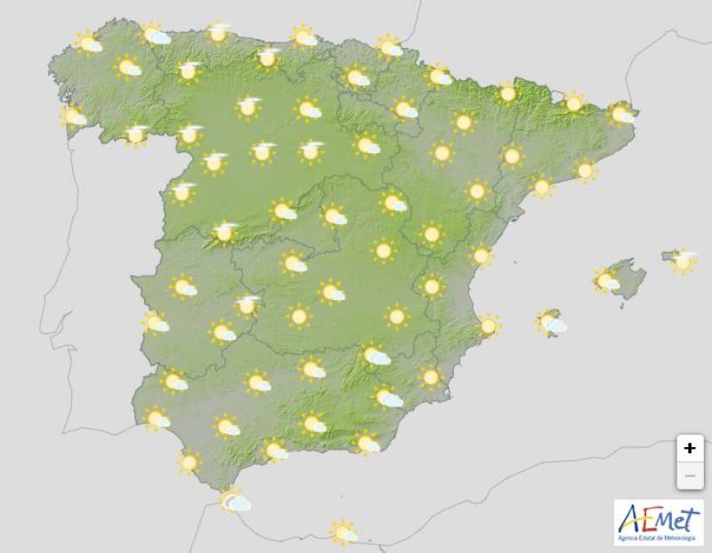
Wednesday is set to be the turning point of the week, as the anticyclone that began the day before is expected to remain over Spain all day.
The clouds should disappear, giving way to clear skies and sunny, warm spells. No rain is forecast aside for a few scattered showers in the extreme northwest.
The mercury will shoot up by a couple of degrees or more in most places, although the temperatures won’t change very much on the Mediterranean coasts.
Thursday November 28
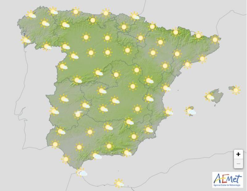
Although the forecast is subject to change, the State Meteorological Agency (Aemet) expects the anticyclonic weather to hold on Thursday, meaning that the day will again be sunny, bright and warm.
The temperatures will again be very pleasant, much milder than this time last week and unusually warm for the last week of November, according to meteorologists.
Join our Spain Weather Watch Facebook group for regular updates
Images: Aemet
Loading
Sign up for the Spanish News Today Editors Roundup Weekly Bulletin and get an email with all the week’s news straight to your inbox
Special offer: Subscribe now for 25% off (36.95 euros for 48 Bulletins)
OR
you can sign up to our FREE weekly roundup!
Read some of our recent bulletins:
25% Discount Special Offer subscription:
36.95€ for 48 Editor’s Weekly News Roundup bulletins!
Please CLICK THE BUTTON to subscribe.
(List price 3 months 12 Bulletins)
Read more stories from around Spain:
Contact Murcia Today: Editorial 000 000 000 /
Office 000 000 000


