To be listed on the haciendadelalamo TODAY MAP please call +34 968 018 268.
Overview of the beaches of Cartagena
72 coves and beaches offer a wide choice in Cartagena
The large municipality of Cartagena has the largest number of beaches of any municipality in the Region of Murcia, and until the water quality problems increased in the Mar Menor was also the recipient of the greatest number of both blue flags and Q for Quality awards.
In total, there are 72 coves and beaches listed in Cartagena, although some are inaccessible on foot and can only be reached via the sea, so are excluded from the list below.
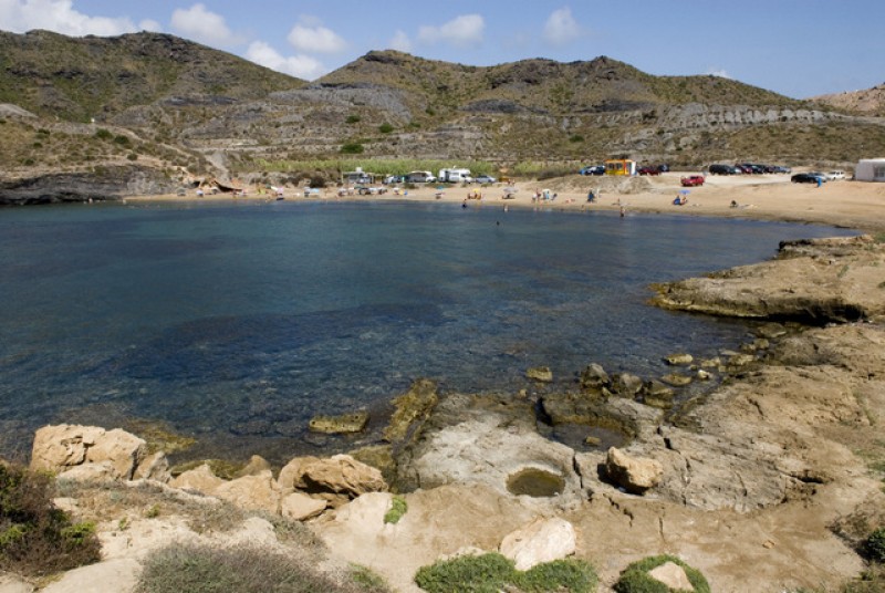
Within the municipality there is a broad beach offering, including Mar Menor beaches, wide Mediterranean sandy beaches which stretch for several kilometres, intimate craggy coves, beaches within the natural protected park of Calblanque, diving beaches on the fringe of the Islas Menores marine park, coves which can only be accessed by sea and family beaches In Isla Plana and La Azohía, close to the Mazarrón border.
Starting with the lagoon of the Mar Menor, here the conditions are extremely safe for bathing, with sandy beaches sloping almost imperceptibly into the warm, shallow waters, some urban, some backing onto the salt flats. Many have lifeguard protection, and various offer superb watersports facilities.
Mar Menor beaches
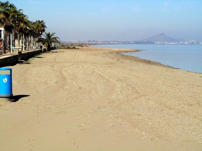
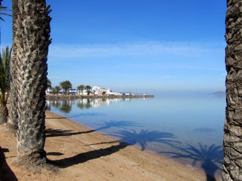
The Mar Menor beaches lie around within the protective circle of Europe's largest saltwater lagoon which covers a surface area of nearly 170 square kilometres, with 70 kilometres of internal coastline. This is separated from the Mediterranean by a 22km long strip of land, La Manga del Mar Menor, connected to the Mediterranean via a canal channel, feeding the Mar Menor with natural saltwater.
The Mar Menor is totally unique, its geographical peculiarities creating some of the best conditions in Spain for those learning watersports, particularly windsurfing and sailing.
Murcia is the warmest mainland region in Spain, and has an average temperature of 18 degrees, which makes it perfect for year-round watersports activity and bathers can enjoy the waters of the Mar Menor for most of the year. The water in the Mar Menor is not tidal and has no currents and only very insignificant waves, so it is perfect for family bathing or watersport beginners (except surfing!).
It has shallow fringes, which slope gently, and is only 7 metres deep in the centre, so the water temperature is warmer than that of the Mediterranean, particularly around the edges where it is possible to wade out 50 metres from the shore and still only be waist deep!
Mar Menor beaches in Cartagena, working from the border with Los Alcázares towards Cabo de Palos:
Playa El Carmolí, a 500-metre long beach alongside natural salt flats and areas of wild vegetation.
Playa Punta Brava, 900 metres long, this is a semi-urban sandy beach.
Playa de Los Urrutias, fine sand and calm water at the beach in the town of Los Urrutias.
Playa Perla de Levante (Estrella del Mar)
Lo Poyo
El Arenal
Playa de Los Nietos, 2.7 kilometres of sand serving the town of Los Nietos.
Playa de Islas Menores, a well served family beach on the shore of the Mar Menor.
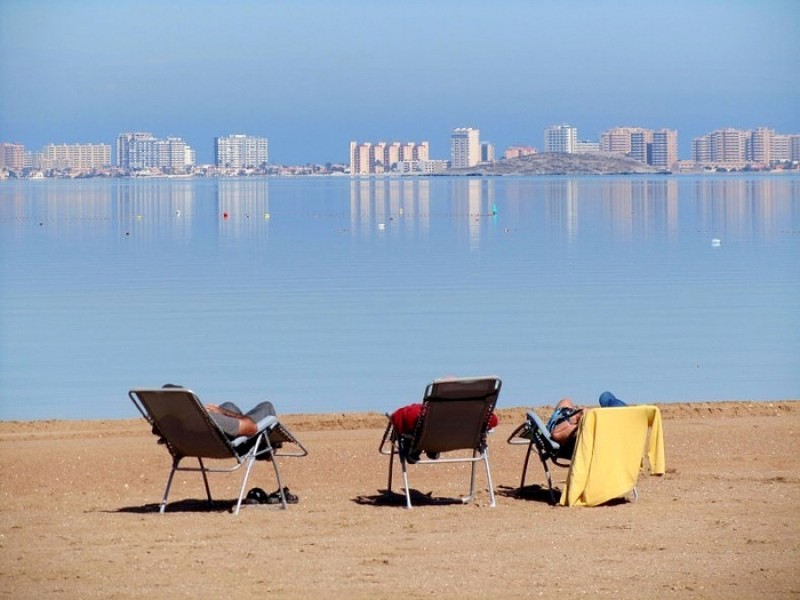
Playa Mar de Cristal, fine sand and spectacular views across the Mar Menor to La Manga.
Playa Lomas del Castillico, a popular beach with windsurfers at the Caravanning park.
Playa Honda, a wide north-facing expanse of fine sand at the southern end of the Mar Menor which is popular with bathers all year round.
Playa Paraiso, an extension of Playa Honda, backed onto not by urban development but by the old salt flats of Marchamalo.
Playa del Vivero, a little gem, tucked away just around the corner from the better known Playa Honda and Playa Paraiso.
Playa de los Alemanes, a golden sandy beach at the southern end of La Manga del Mar Menor.
By this point the southern tip of the Mar Menor has been reached and the following beaches are on the Mar Menor coast of La Manga del Mar Menor.
The La Manga strip is divided into two sections for administrative purposes, although there is no geographical difference, the northern end belonging to San Javier and the southern part, starting at Cabo de Palos, lying within the boundaries of Cartagena.
Beach location is generally defined by kilometre reference. Km 0 is the tourist information point at Cabo de Palos and km 18 is the far end of La Manga by the Esculls de la Llana y Encañizadas, which is where dry land runs out!
Playa de la Gola, the stretch of sand just to the south of the Gola de Marchamalo, one of the channels linking the Mar Menor to the Mediterranean.
Playa Puerto Bello, 500 metres of sandy beach just outside the Puerto Bello marina.
Playa Cavanna, a long, curving Mar Menor beach located between the Dos Mares marina and the Gola de Marchamalo.
Playa Dársena Dos Mares, a popular location for surfboarders and kiteboarders.
Playa de Gollerón (Bahía de Palmeras), a hidden cove tucked away on the Mar Menor coast near the Isla del Ciervo.
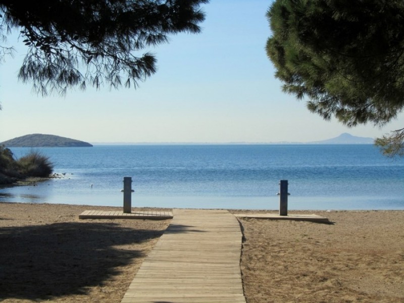
Cala del Pino, a gem of a beach with a shady pine grove and views out towards Los Alcázares and the islands of the Mar Menor.
At this point the municipality of Cartagena abruptly comes to an end and all points north of Cala del Pino in La Manga lie within the boundaries of San Javier.
Walking across the carriageway, the beaches then continue down the eastern side of La Manga del Mar Menor on the shore of the Mediterranean, heading back south towards Cabo de Palos. This rocky headland boasts a series of wild coves and unusual bathing options, as well as the crystal clear waters of the Islas Hormigas marine reserve. Before arriving at Cabo de Palos, however, the Cartagena coastline offers some of the largest and most popular beaches in the Region of Murcia.
Playa Calnegre (also known as the Playa de Monte Blanco), 500 metres of sandy Mediterranean beach.
Playa Galúa Click: Playa Galúa, one of the most iconic beaches which cemented the popularity of La Manga in the 1970s.
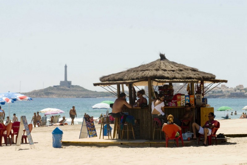
Playa del Barco Perdido (divided into three vast beaches, each 1.8km in length!): Playa del Barco Perdido Entremares, Playa del Barco Perdido Sirenas and Playa del Barco Perdido Zeus.
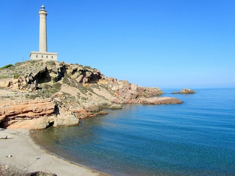
This brings us to the southern end of La Manga del Mar Menor and the town of Cabo de Palos, named after the rocky outcrop on which the lighthouse stands. Here the long sandy beaches are replaced by sandy coves and rocky inlets and the area is popular with divers and snorkelers, who enjoy the clear waters of the Cabo de Palos and Islas Hormigas marine reserve. The coves continue around the headland of Cabo de Palos and past the port, offering a range of interesting bathing propositions:
Playa las Amoladeras, a wide expanse of golden sand next to a nature reserve at the southern end of La Manga.
Playa Levante, a sweeping curve at the foot of Cabo de Palos providing views along the length of La Manga (Blue Flag).
Cala de las Escalerillas, a pretty rocky cove but just a tiny stretch of beach.
Cala Túnez, an attractive sandy cove in the shadow of the Cabo de Palos lighthouse.
Playa Calafría, a small but spectacular beach looking out towards Islas Hormigas (for further information.
Cala del Muerto, a gravel beach near the lighthouse.
Cala Roja, a south-facing beach accessed by stone steps.
Cala Botella and Cala Mayor, difficult access to craggy coves on the southern shore.
Cala Melva, pebbly coves just east of the marina.
Playa La Barra, bathing on the seafront but no actual beach in this urban area.
Cala Abellán, shallow rock pools west of the marina.
Cala Medina: rocky coastline in the southern part of Cabo de Palos
Cala Flores, fine grey pebbles on the beach of a picturesque cove.
Playa del Descargador, a small but picturesque rocky cove with spectacular views.
Cala Reona, pectacular scenery and soft sand next to the Calblanque nature reserve.
Here the coastline enters the regional park of Calblanque, a protected area which contains some of the finest natural beaches in the Murcia Region. During summer months the numbers entering the park are carefully controlled to protect the environment. These are wild beaches with no services other than a lifeguard on Playa Calblanque during peak months.
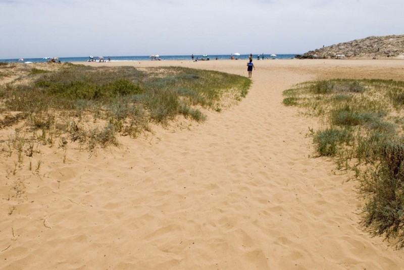
Click for further information about the Playas de Calblanque (Cala Magre, Cala Dentones, Cala Arturo, Playa Calblanque, Playa Las Cañas, Playa Larga, Playa Negrete, Playa Parreño, Cala Las Mulas, Cala Galera and Cala Barco).
The coastline continues towards Cartagena with a wall of craggy coast accessible only by boat. The only break until the outskirts of Cartagena, skipping the bay of Portmán in the municipality of La Unión, is El Gorguel, a wide sandy beach surrounded by the mineral wastes of the Sierra Minera.
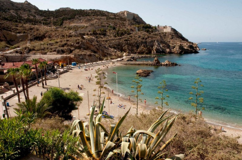
On the outskirts of the city lies the nearest beach to the city centre, a popular urban beach with Blue Flag status: click for further details regarding Cala Cortina.
West of the city of Cartagena and Algameca the coastline again becomes rocky and difficult to access from land. Three sandy calas on the southernmost tip are best reached by boat, namely Playa de la Parajola, Playa Fatares and Cala del Gallito.
However, the next two beaches are accessible by land vía Galifa. Playa El Portús is a former fishing village and is a small, sandy cove, with a naturist colony above it . Alongside this is Playa Morena, a rough, sandy cove. This area is very popular with residents of the Cartagena Campo to the south of Cartagena.
The vast coastline of Cartagena continues, with several small coves dotted along the coastline. Some can be reached by land, but with difficulty as the access is all via privately owned properties and there are no roads and only a dew dust tracks leading to areas such as these. A coastal walk runs along from La Azohía, via which some beaches can be reached, but this does require a fair hike across mountainous countryside. A couple of the coves are very pretty, but are best accessed via boat.
These coves are Cala Aguilar, Cala El Bolete, Cala Bolete Grande, Cala del Pozo de la Avispa, Cala Salitrona, Cala Mojarra and Cala Cerrada, the last of which can be reached from the road which leads to the Castillitos gun battery.
As the coastline approaches Mazarrón it once again opens up to a stretch of sandy and shingly beaches in the popular villages of La Azohía and Isla Plana, with a couple of attractive coves amongst them. These are all very popular beaches with those who prefer a family atmosphere and a less densely populated atmosphere.
La Azohia Beaches:
Playa de La Azohía or "Playa del Cuartel", a Blue Flag beach popular with family groups and snorkelers.
Playa de la Chapineta, a small but very popular beach close to local restaurants and the only supermarket in town!
Playa de San Ginés, a long Blue Flag beach very popular with bathers and served by various beach bars.
Isla Plana beaches:
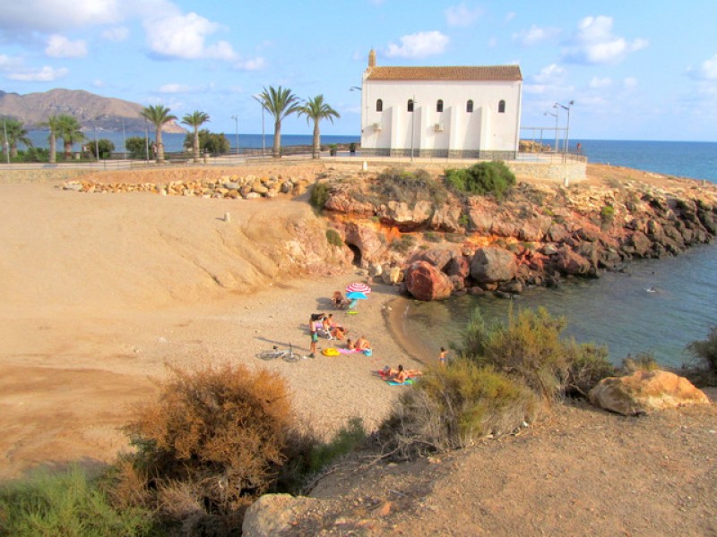
Playa La Calera, named the only dog-friendly beach in Cartagena in 2018.
Playa de Isla Plana, a popular Blue Flag beach just next to the centre of the village.
Playa La Caleta
Cala Maestre Romero
Cala del Contrabando
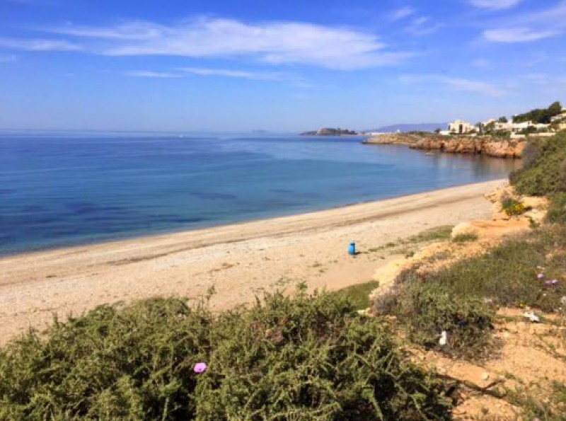
Playa del Corral, a popular although mostly stony beach choice just below the residential areas of Mojón Hills and Ladera del Mar.
Other Cartagena Beaches


