
To be listed on the haciendadelalamo TODAY MAP please call +34 968 018 268.
Murcia Gota Fría storm and flooding September 2019: overview
Three days of torrential storms which will live in the memory for many years
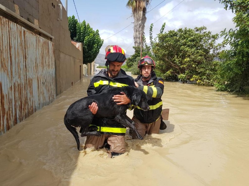
Those whose familiarity with the Region of Murcia and the rest of south-eastern Spain goes back years have learnt never to underestimate the destructive power of the “gota fría “ storms which often bring flooding and chaos, and even the loss of human life, right along the Spanish mediterranean coastline during the autumn, but the episode which occurred in September 2019 is among the most dramatic of recent decades.
To understand what a Gota Fría is, click here to read a full explanation of the meteorological conditions which lead to Gota Fría occurring; remember, these happen every year, in different points of the Spanish Mediterranean coastline, and the degree of severity varies considerably. Very often a Gota Fría is only considered to be a "bad one" if human lives are lost, although the degree of the flooding can also affect the severity of the storm. Storms are usually highly localised, so receive little attention; generally the wider public only become aware of their existence because of deaths or a specific incident which receives media attention.
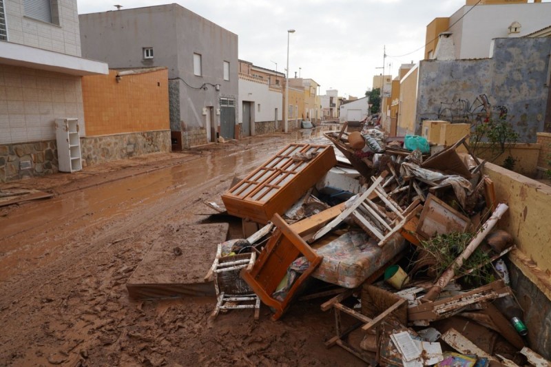
The washing away by floodwater of the campsite in Bolnuevo in 1989, the disaster in Lorca and Puerto Lumberas in 2012 ( in which 13 people were killed), the scenes of devastation after a flash flood in Camposol in 2014 (nobody was killed, the devastation in this specific area was highly localised)... all of these stick in the memory, and most people living in Murcia recall episodes of localized flooding which brought home the power of the rain in Spain. But most sources believe that the huge storm which struck in mid-September 2019 was one of the most powerful on record due to the extent of the area it covered, which included all of the Valencia region, perhaps most recently matched by the one in 1982, when the River Segura burst its banks in the city of Murcia: others describe it as the heaviest storm in 140 years!
The first warnings that a violent storm was on its way to the Costa Cálida began to appear on Monday 9th September, when the State meteorological agency Aemet published a statement to the effect that an isolated high altitude depression (known in Spanish by the acronym DANA) was heading towards the Mediterranean coast of Spain from the Bay of Biscay. Over the following days the warnings grew more and more serious, until on Wednesday night, for the first time ever, the entire Region of Murcia was placed on red alert status for probable heavy rain on both Thursday 12th and Friday 13th September.
Many were still sceptical, aware that Aemet’s role is to ensure that people are forewarned in the event of torrential rain, but on this occasion the meteorologists’ warnings were fully justified. The rain began to fall in central Murcia on 12th September, with extremely violent storms hitting the regional capital and the Ricote valley during the morning, bringing over 200 millimetres of rain to Molina de Segura (the average figure for a whole year is approximately 300 mm) and well over 100 mm in Cieza, Murcia and Archena. In Murcia
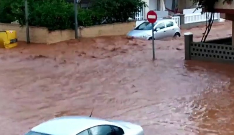
Despite the public having been urged to consult the detailed CHS map of areas which are susceptible to flooding the authorities began to rescue stranded motorists who had ignored the advice not to venture out in the car, and it was announced that all schools in the Region of Murcia were to be closed on Friday 13th September for the second day in a row as a precautionary measure.
Before Thursday ended 87 people were evacuated from their homes in Archena and taken first to the local sports pavilion and then to the Balneario thermal spa resort to spend the night, while others were evacuated in Beniel as the Segura began to burst its banks east of the city of Murcia: over the coming 24 hours the total of evacuees was to rise to over 1,000.
For a while on Thursday the intensity of the rain in Murcia was scarcely believable, but Aemet continued to warn that the worst was yet to come, and again the meteorologists were right. If the main cloudburst on Thursday morning lasted for an hour or so, then during the night a similar cloudburst lasted for hours. 300 millimetres of rain were recorded in La Manga del Mar Menor and parts of the Cartagena, most of it falling in the space of four or five hours, and throughout the Region of Murcia significant quantities accumulated as streets and fields alike filled with water.
Infrastructure everywhere was placed under tremendous pressure, and ramblas burst their banks all over the region, causing localised flooding. One of the most important of these was the Trasvase Tajo-Segura, a major infrastructure which transports water from the north to the south which was ruptured near to Molina de Segura.Millions of litres of water plummeted to the ground, fortunately most of it falling into the rambla of Molina de Segura which in turn flowed to the reservoir at Santomera.
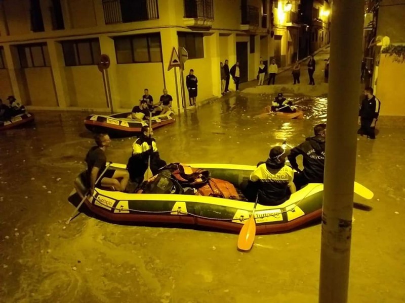
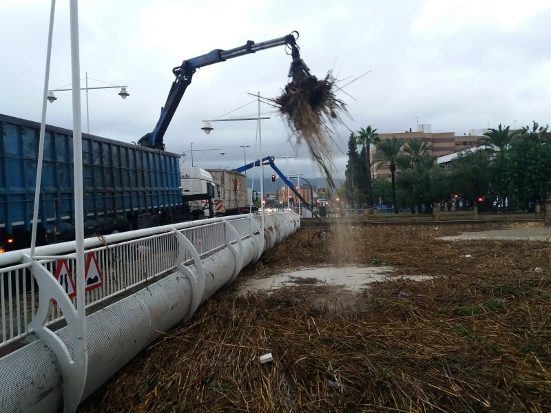
By this time the rain which had fallen the day before in the Ricote valley and in Molina had made its way downstream in the River Segura, which was within centimetres of bursting its banks in the centre of the city of Murcia. Fortunately that calamity was averted as the CHS, which manages the water infrastructure of the region, managed to extract tons of debris and improve the flow of water, but during the day the river and other irrigation and drainage channels overflowed slightly further downstream.
Much of the fertile farmland of the Vega Baja, the flood channel of the Segura between Murcia and the Mediterranean, soon lay under water, not only in El Raal, Beniel, Santomera and other locations in the Region of Murcia, but also in the south of the province of Alicante, where the historic monumental city of Orihuela was flooded when the Segura again broke its banks.
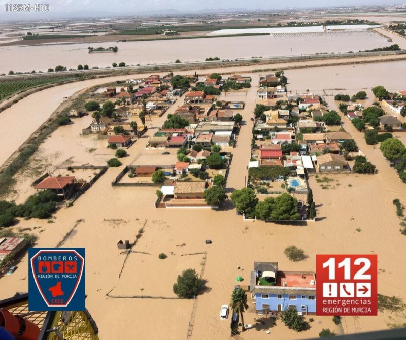
On 13th September, though, the torrential rain spread further south, and parts of the Campo de Cartagena (as well as the city itself) also found themselves inundated. Inevitably much of the floodwater made its way towards the Mar Menor, where the fragile ecosystem of the largest saltwater lagoon in Europe was subjected to a barrage of debris, agricultural fertilizers and other flotsam and jetsam as cars, street furniture, bins and even melons and other crops accumulated as flood defences were unable to cope with the onslaught.
Over 330mm of rain fell in San Javier, the AP7 was totally overwhelmed and flooded as the rambla del Albujón burst its banks and inundated the main motorway linking Murcia and Alicante, the airport at Corvera was closed, creating passenger chaos as those scheduled to fly home tried to find solutions on social media as to whether they should ignore the advice being given by the regional government not to drive anywhere, a lack of information from the airlines failing to inform them whether their flights were cancelled or diverted.
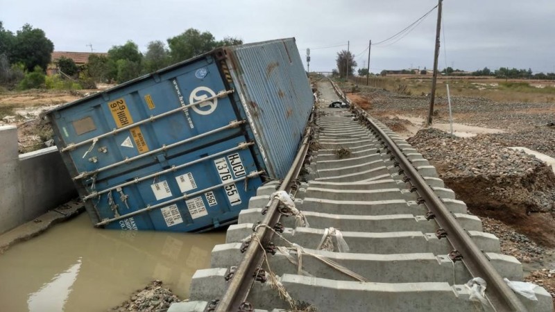
Railways lines were shut due to the sheer volume of water falling which flooded tunnels and ripped track from the ground leaving the Region of Murcia virtually isolated.
After 236 millimetres of rain fell in just 3 hours between 23.30 on Thursday and 2.30 on Friday 80 people were evacuated from Camping Caravanning near Playa Honda at the southern end of the Mar Menor and taken to the Guisel de Guimbarda de Cartagena sports pavilion in Cartagena, while numerous calls for help were received from people needing to be rescued from their homes in Los Nietos.
At the same time the heath centre in La Puebla was closed after the Rambla del Albujón overflowed and flooded the premises, and further north 56 people were evacuated in Cieza from the Cabezo de la Fuensantilla just before the River Segura burst its banks.
During the day the flooding threatened even greater disaster on a number of fronts. The reservoir of Santomera, where reserves had stood at just 7 per cent of capacity before the rain arrived, was suddenly completely full as water cascaded into it, and in order to avoid either an overflow or the dam breaking the CHS was forced to open the flood gates and allow water to rush down onto lower ground. That potential catastrophe was averted, but of course the water allowed out added to the flooding on lower ground in the Vega Baja, compounding the problems as the canal designed to carry excess water in this eventuality proved inadequate for the task and breakages and overflows were reported.
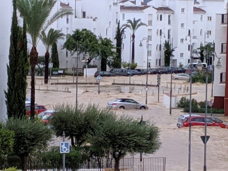
As 13th September came to an end the rain eased off, but the “gota fría” was not over yet. As the centre of the storm headed west towards Granada there was a tremendous display of thunder and lightning during the night, from the city of Murcia to the south-west of the Region, and more rain accompanied the deafening thunderclaps. Further showers followed on Saturday before by Sunday 15th September the “gota fría” finally left Murcia behind, mustering a last downpour as far away as the region of Madrid as it receded to the north.
The Mar Menor
As the sky cleared and the water began to drain away it became possible to reach those areas where most damage had occurred, and the extent of the damage on the inland shore of the Mar Menor became apparent. In Los Alcázares, Los Nietos, San Javier and Los Urrutias the level of the water in the lagoon had risen by 70 centimetres as the narrow “golas” which connect the Mar Menor with the Mediterranean had not been able to compensate for the sudden arrival of so much water, and as a result the beaches and seafront promenades had completely disappeared under water. All of the municipalities affected in the area were among those to request a declaration of “catastrophe area”.
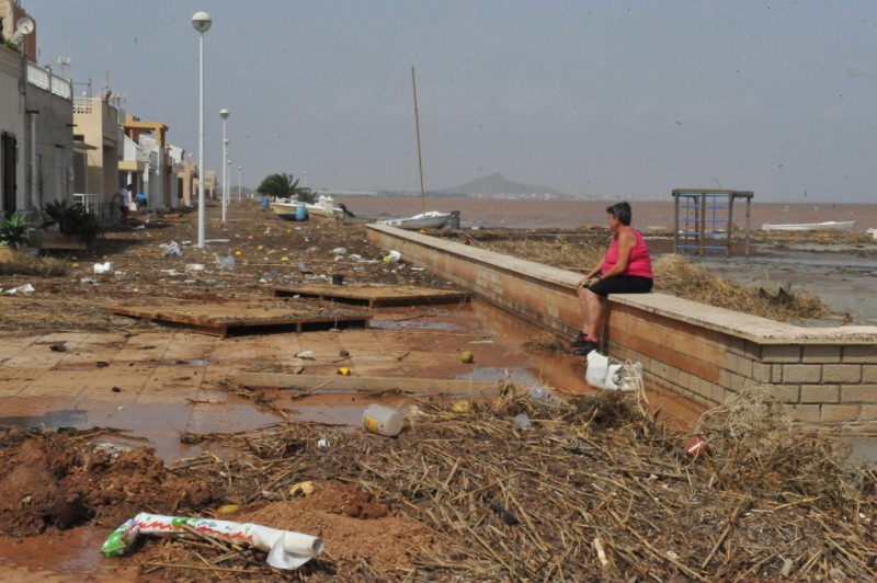
But the damage was far from being limited to the shoreline. Los Alcázares had already been declared a disaster area in December 2016 following another flood, and the Mayor described the 2019 storm as “three times worse”. Water running towards the Mar Menor had carried all before it, and of course everything which failed to reach the lagoon remained in the streets of Los Alcázares in a flood of muddy water.
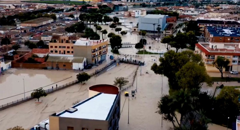
At one point the Mayor could offer no constructive advice to residents apart from to take refuge on upper floors of their homes where possible until rescuers arrived, among them over 1,000 members of Spain’s Military Emergencies Unit and, as the roads became passable, a small army of volunteers. Three impromptu shelters were set up with a capacity to sleep 600 evacuees as the military moved in to help evacuate and rescue them from their homes.
The scene in Los Nietos was also one of utter devastation, with residents emptying their ground floor homes of ruined furniture as they swept and mopped mud and water out of them, and similar sights were to be seen all along the western edge of the lagoon.
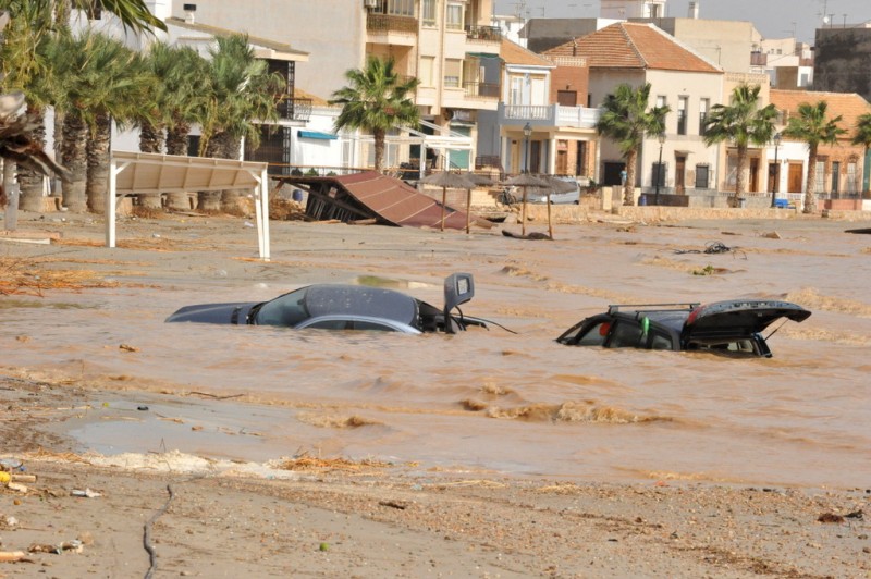
It will take months or possibly years for the damage caused by the storm to be repaired, but in the Mar Menor itself the harmful effects could prove to be even longer-lasting. At one point it was estimated that around 20 per cent of the water in the lagoon had reached it from the farmland of the Campo de Cartagena during the storm, and there are fears that the presence of fertilizers, sewage and other debris could do irreversible damage to the marine environment.
Whether this is the case will begin to become apparent in the coming months.
Assessing the damage caused by the gota fría of September 2019
It has to be remembered that the Gota Fría of September 2019 was obviously not limited to the Region of Murcia – weather phenomena do not respect arbitrary boundaries drawn by Man – and when assessing the damage done during the storm the first figure to highlight is the loss of 7 lives. None of the deaths occurred in the Region of Murcia, although two were just a few kilometres away in the municipality of Orihuela (province of Alicante) and another nearby in San Fulgencio, the others being in Almería, Granada and Albacete.
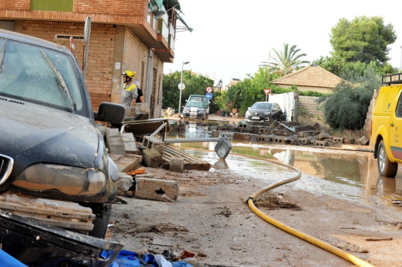
Within the Region of Murcia, well over 1,200 regional emergency services staff took part in operations to limit and repair damage and to rescue people from their homes and vehicles, helped by countless volunteers and businesses which supplied vehicles capable of reaching the worst-hit zones. Many farmers contributed with their tractors as they entered otherwise inaccessible areas.
First estimates are that insurance claims made by around 30,000 people in relation to the flooding will amount to around 190 million euros, although those calculations figures could easily err on the conservative side.


