To be listed on the haciendadelalamo TODAY MAP please call +34 968 018 268.
Águilas beaches: Cala de La Herradura
One of a series of semi-wild beaches at the western end of the Águilas coastline
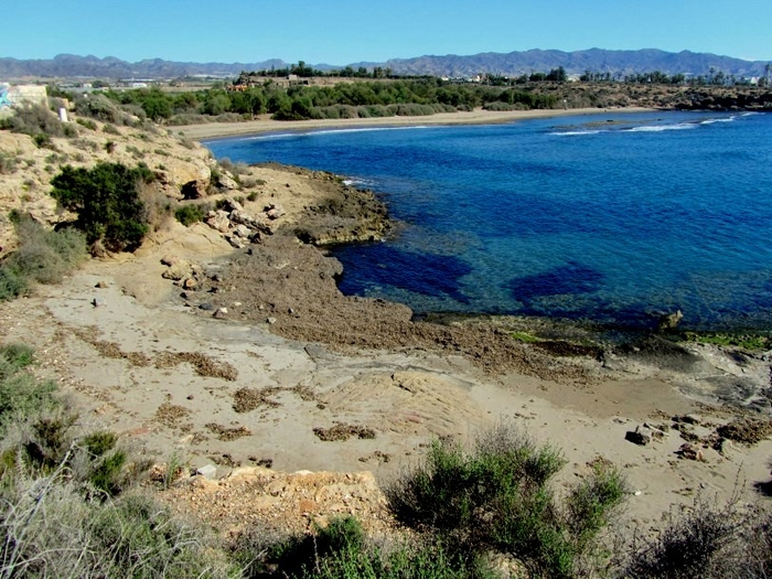
 La Herradura is a tiny cove towards the western end of the Águilas coastline, located on the headland which is at the south-western end of the Playa Matalentisco.
This is the seventh beach of 36 in the Águilas municipality along 28 kilometres of coastline, running down from the Almería border and is a semi-wild beach.
The name of the beach, “La Herradura”, means “the horseshoe”, and on seeing the shape of the cove it’s not hard to understand why it was given this name. It’s only 40 metres long and 11 metres wide, and lies in an almost semi-circular niche which has been eroded in the side of the headland.
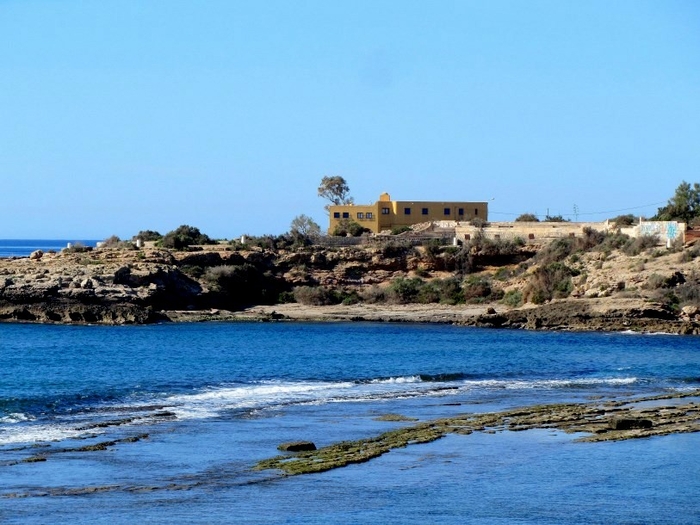
Access to this cove is either on foot from the Playa Matalentisco or by one of the rough tracks which lead from the main RM-333 road between Águilas and San Juan de los Terreros. These tracks are usable by motor vehicles, but it’s quite easy to become lost as there is no signposting to differentiate one beach from another: to find La Herradura, the best advice is to head for the yellow house which is visible on the headland behind it!

As is to be expected at such a small, out-of-the-way location, there are no beach facilities here. This is a place to enjoy a little privacy while sunbathing, swimming or snorkelling, but don’t forget to take a snack and something to drink as it is necessary to drive for any type of beach or hostelry services.
Click for further information regarding the beaches of Águilas.
More information about Águilas including beaches, what to see, what's on and tourist information can be found on ÁGUILAS TODAY


